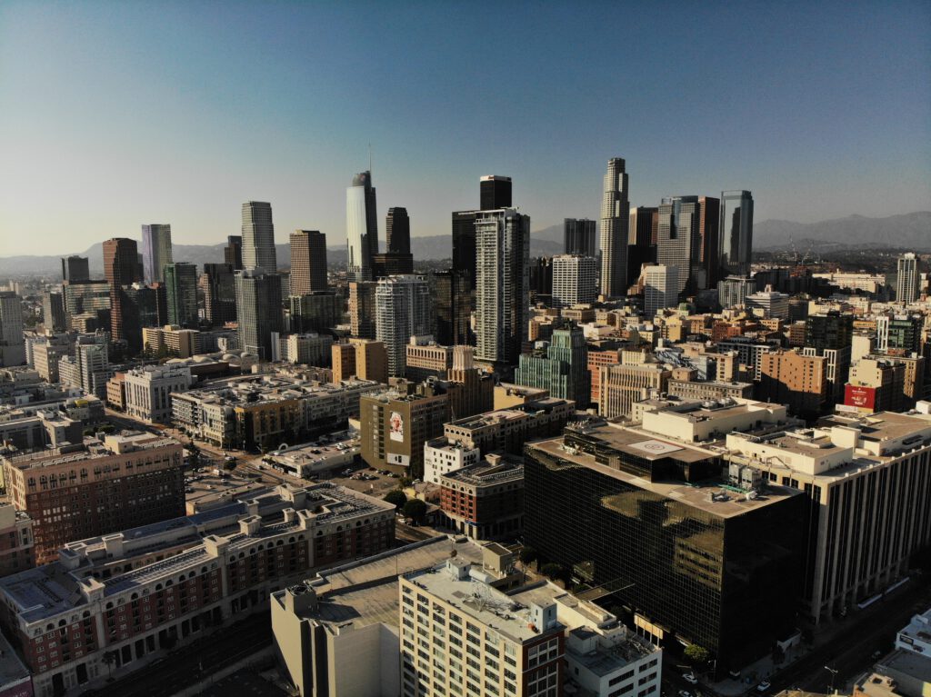
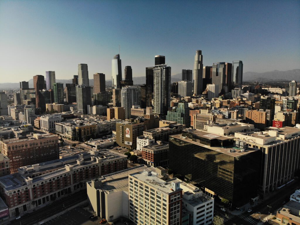
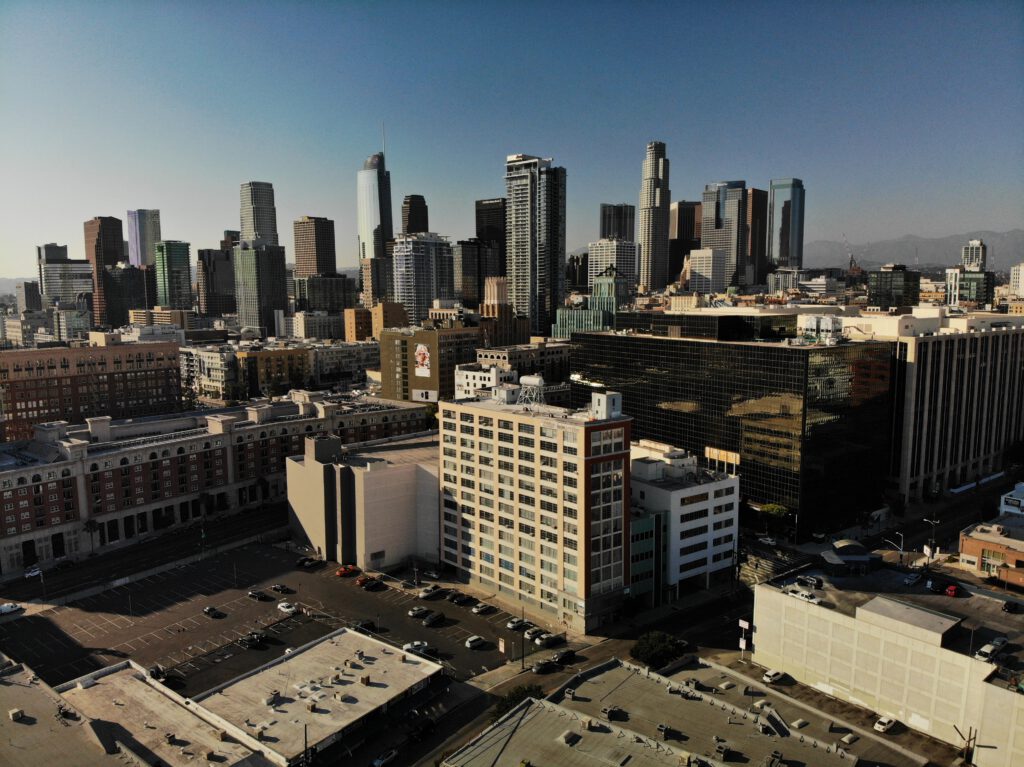
Los Angeles has a population of 3,694,813
And 2,937 people per square kilometer.

Downtown LA

Downtown LA

Downtown LA

Downtown LA
City foundation
The first European in the region was the explorer Juan Rodríguez Cabrillo, who claimed the land for Spain in 1542 without establishing a settlement. In 1771, Spanish Franciscan monks founded the „San Gabriel“ mission near Whittier Narrows, which later formed the starting point for colonizing the region. The Spanish missions in California were designed to expand Spanish influence and the power of the Church. To protect them from attacks by the indigenous people living there, the mission was fortified.
After the mission was established, the Spanish governor of California, Felipe de Neve, sent eleven families to cultivate the land. On September 4, 1781, the Los Angeles Community was established with 44 settlers on the territory of the Tongva indigenous people. At that time there was still mainly cattle breeding. In the following decades the first US settlers established themselves in the region.
In 1821 Los Angeles fell to Mexico, which had gained independence from Spain after a long war. In 1835 the Mexican Congress elevated the settlement to the status of a city and the capital of Mexico’s northernmost region, Alta California. The second part of the decree was never enforced and was soon revised. So Monterey remained the capital of California until 1849. The population of Los Angeles grew to 2,228 people by 1836, after which it fell again temporarily. Los Angeles was a Mexican community until the mid-19th century, but it consisted primarily of American settlers, poor Chinese workers, and a few wealthy Mexican landowners.
In 1846 the schoolmaster William Ide proclaimed the independence of California. The republic only existed for a short time. During the Mexican-American War between 1846 and 1848, Alta California and with it Los Angeles were occupied by US soldiers and annexed to the USA. In 1848 gold was found north of Sacramento, which triggered the famous gold rush. Numerous prospectors came to the area, from which Los Angeles also benefited by selling meat, fruit and vegetables to the Diggers.
Shortly thereafter, the first of two European pharmacists (both of German descent) arrived in Los Angeles. The first was the pharmacist Theodore Wollweber. In 1861, Adolph Junge became the second pharmacist. He ran his drug store in Temple Block on Main Street for around 20 years. The later well-known German pharmacist F. J. Gieze worked as an employee at Junge in 1874. The young recipe book and his estate are now in the Natural History Museum of Los Angeles.
The photos were created by Dominick Kruger and taken in Downtown Los Angeles.
name of the city
The city was officially founded on September 4, 1781 by the Spanish governor Felipe de Neve as El Pueblo de la Reina de Los Ángeles (Spanish „The village of the Queen of Angels“). [8] The name thus referred to Mary as Queen of Angels, a Mary title that comes from the Lauretan litany. The current name Los Angeles is an abbreviation of the founding name on „the angels“.
The unofficial name El Pueblo de Nuestra Señora la Reina de los Ángeles del Río de Porciúncula [el ˈpweβlo de ˈnwestɾa seˈɲoɾa la ˈrei̯na de los ˈaŋxeles del ˈrio de poɾsiˈuŋkula] (The Lady of the River Angels) was also widespread Portiuncula). [8] It makes specific reference to the Basilica of Santa Maria degli Angeli in Assisi, built over the Portiuncula chapel, in which Francis of Assisi died. He was the founder of the order that included the missionaries who came to America with the explorers.
Contrary to popular belief that this was the original name, scientists have found from official documents from Governor Felipe de Neve, Commander-in-Chief Theodor de Croix and Viceroy Antonio María de Bucareli y Ursúa that the settlement was simply called El Pueblo de la Reina de Los Ángeles wore.
The abbreviation often used (also colloquially) is „L.A.“. Because of the Spanish meaning of the city name, the city is nicknamed the City of Angels.
geography
location
Satellite image of Santa Monica Bay
The city center and the suburbs of Los Angeles lie in a hilly coastal region on average 100 meters above sea level. [9] To the west and south, the city is bordered by the Santa Monica Bay of the Pacific Ocean. In the east and north it is surrounded by mountain ranges. Also in the north of the city is the San Fernando Valley, where a third of the residents live in single-family homes. The valley is cut off from Hollywood and downtown by Griffith Park and the Santa Monica Mountains.
The administrative city area has an area of 1290.6 km². Of this, 1214.9 km² are land and 75.7 km² are water. The urban area extends 71 km in north-south direction and 47 km in east-west direction. It is connected by a system of highways made of steel and concrete structures. The city is burdened by the greatest density of motor vehicles in the world, and car and industrial emissions have become an urgent environmental problem. As a result, Los Angeles is one of the most exposed cities in the United States from smog.
The city is sometimes referred to as the horizontal city because it has relatively few skyscrapers and the entire urban area is very extensive. In the center of Los Angeles, however, high land prices mean that high-rise buildings are now also establishing themselves there. The agglomeration, i.e. the continuously built-up area, covers an area of 4320 km².
There are several definitions of the Los Angeles metropolitan area:
The Metropolitan Statistical Area (MSA) comprises the 15 boroughs (Districts) of Los Angeles and the two counties of Los Angeles (Metropolitan Division Los Angeles-Long Beach-Glendale) and Orange (Metropolitan Division Riverside-San Bernardino-Ontario). It has a floor area of 12,562 km².
The Combined Statistical Area (CSA) includes 173 independent cities. It includes Los Angeles, San Bernardino, Riverside, Ventura, and Orange counties. The extended metropolitan area thus extends to the border of Nevada and has an area of 87,941 km². Only a fraction of this area is used for urban development. The largest part consists of uninhabited parts, namely the Mojave Desert and Joshua Tree National Park, which is located in Riverside and San Bernardino Counties.
geology
3D representation of the Los Angeles Basin based on a satellite image
Interstate 10 bridge on La Cienega Boulevard damaged by the 1994 Northridge earthquake
The San Andreas Fault runs on the eastern edge of the metropolitan region; in addition, the Puente Hills Fault is just below the city. The resulting earthquake hazard explains the stringent building codes that are in place throughout Southern California’s earthquake area. Since 1800, Los Angeles has been hit by nine major earthquakes, magnitude six and higher, and thousands of smaller quakes. Numerous buildings are earthquake-proof, which significantly reduces the number of deaths in quakes.
Until 1958, there was also a legal requirement according to which the upper limit for buildings could not exceed 45 meters or 14 floors. The only exception was the town hall from 1928 with 138 meters. Earthquake-proof constructions later made the law superfluous. The danger of earthquakes, the move away from dense development and the establishment of a guide
bildes, according to which Los Angeles should be more of a kind of „City in the Garden“, were the idea behind this regulation. This, too, is an explanation for the expansion of the city.
The worst earthquake in recent history was the Fort Tejon earthquake on January 9, 1857, near the present-day parishes of Wrightwood and Palmdale. The magnitude 7.9 earthquake caused only minor damage, as the region was sparsely populated at the time. If such a quake occurred today, it would cause billions of dollars in damage and significant human life losses.
On March 10, 1933, the Long Beach earthquake with a magnitude of 6.4 claimed 120 lives. Property damage of $ 50 million resulted in Long Beach and other locations. Many of the damaged buildings were not built to be earthquake-proof. Another major earthquake occurred on February 9, 1971 with a magnitude of 6.6. The so-called San Fernando earthquake of 1971 (also known as the Sylmar earthquake) caused damage of 500 million US dollars in the San Fernando Valley and claimed 65 lives. The earthquake on June 28, 1991 had a magnitude of 5.8 but caused no surface fracture because of its depth. Nonetheless, there was damage amounting to 40 million US dollars, mainly in the San Gabriel Valley.
On January 17, 1994, a 6.7 magnitude earthquake struck the city of Los Angeles. The epicenter of the Northridge earthquake was in the Reseda neighborhood of the San Fernando Valley. 57 people were killed and 12,000 injured. Major transport links and an estimated 100,000 buildings were damaged or destroyed. According to the Federal Emergency Management Agency (FEMA), property damage amounted to $ 40 billion. [10]
In 2008, the US Geological Survey (USGS) and the Southern California Earthquake Center published a new study. The researchers forecast a major earthquake of magnitude 6.7 for California by 2038 with a 99.7 percent probability. A quake of magnitude 7.5 or more was predicted with a 46 percent probability. Greater Los Angeles is a little more at risk than San Francisco in the north of the state. The possibility of a magnitude 6.7 quake is 67 percent in Los Angeles and 63 percent in San Francisco. [11]
On July 29, 2008, at 11:42 a.m. local time, a 5.4 magnitude earthquake was recorded. The epicenter was about 46 km east-south-east of the city center, near Chino Hills. [12]
City structure
Downtown Los Angeles with Wilshire Grand Tower, the tallest building in the city
View of the Los Angeles Basin from Mount Wilson at night
Los Angeles is divided into 15 districts. The population figures refer to the census of April 1, 2000. [13]
Aerial view over Los Angeles. In the foreground are residential areas, bordering on industrial and business districts. Glendale and part of the Santa Monica Mountains can be seen in the background. Downtown is centrally located.
The Los Angeles area is characterized by extreme urban sprawl. The entire city is broken up like a mosaic into a multitude of individual city districts. The districts have different functions, such as business districts or residential areas, and are clearly differentiated from one another. In the individual residential districts there are population groups who also differ significantly in terms of origin, education, income or age structure. The districts are partially isolated from each other, and not infrequently even sealed off by walls or fences. [14] There is no dominant center in the entire city region. Downtown Los Angeles has the only collection of skyscrapers in the huge sea of houses and also has a symbolic meaning, but it is only one of many districts. Within the agglomeration of Los Angeles there are many districts with their own center, character and specialized functions, such as Long Beach, Santa Ana, Anaheim or Pasadena.
This diversification and fragmentation is both a problem, but it can also be one of the reasons for the city’s rise. Come on
Angeles is one of the most heterogeneous [15] cities in the world, shaped by the individualism of its residents. Different milieus and lifestyles exist side by side, [16] as a result of which the urban space can no longer be recognized as a coherent unit. This is particularly reflected in the lack of a clearly identifiable center. [17] A number of new terms have been developed for these postmodernist forms of settlement since the end of the 20th century, such as Exopolis, Postmetropolis or the term Zwischenstadt. Such cities are often referred to as edgeless cities or edge cities, as suburban, post-urban or even desurban areas. [21] [22] [23] The term urban country hybrid is an attempt to take account of the developments in post-modern forms of settlement – with a focus on Los Angeles. Such agglomerations represent a new kind of spatial development, „the prerequisite for which is extensive suburbanization.“ [16] The research group at the Los Angeles School of Urbanism devoted itself to researching these developments, particularly in the late 1980s and 1990s. [24]
climate
The city is located in the subtropical climate zone. The average annual temperature is 18 degrees Celsius and the average annual rainfall is 305 millimeters. The warmest months are July and August with an average of 22.8 degrees Celsius and the coldest is January with an average of 13.2 degrees Celsius. Almost all of the annual precipitation falls in the months of November to March, so it is mostly dry between May and October.
In the summer in Los Angeles during the day temperatures usually around 22 to 25 degrees Celsius. Without the location on the Pacific coast, it would be even warmer as the wind from the sea weakens the temperatures. In winter, on the other hand, it is a little colder, with temperatures almost never dropping below 15 degrees Celsius. At night, the temperature drops by an average of around ten degrees Celsius. The humidity is 50 to 75 percent.
Typical of the climate in the Los Angeles region are also several, relatively clearly delimited, smaller climate zones. The main reason for this lies in the various mountain ranges that separate the Los Angeles Basin from, for example, the San Fernando Valley and other areas further inland. In the San Fernando Valley, for example, it is often several degrees warmer in summer than on the coast, while it is noticeably cooler there in winter.
Heat waves occur every two to three years and temperatures can rise to over 40 degrees Celsius. The reason for this are the so-called Santa Ana winds, which come over the Santa Ana Mountains from the deserts east of the city. Extensive forest and bush fires occur again and again. On October 3, 1933, one of the worst bush fires in the United States killed 29 firefighters in Griffith Park. Between late October and early November 1993, fires in the Los Angeles metropolitan area destroyed thousands of acres of built-up land. [25] The highest temperature was measured on July 22, 2006 in Woodland Hills with 48.3 degrees Celsius, the lowest temperature on February 6, 1989 in Canoga Park with −7.8 degrees Celsius. [26] [27]
[wpedon id=2955]
